UN
Corbally
£ 508,000
Description
We don't have a Description for this property.
- Bedrooms
- 4
- Bathrooms
- 0


Leaflet © OpenStreetMap contributors
The heatmap indicates the level of crime in the area. The color of the heatmap indicates the crime severity and recency.
Metrics Year-on-Year
- Average area value
- 400,449.00 £Increased by 9.05 %
- Average area rental value
- 1,078.00 £/moDecreased by 1.73 %
- Est rental Yield
- 3.23 %Decreased by 9.78 %
- Crime Rate
- 7.00 %Unchanged by 0.00 %
from 367,227.00 £
from 1,097.00 £/mo
from 3.58 %
from 7.00 %
Nearby Schools
| Name | Type | Ofsted | Distance |
|---|---|---|---|
| Langstone Primary School | Welsh Establishment | 0.60 KM | |
| Llanmartin Primary School | Welsh Establishment | 1.48 KM | |
| St Gabriel'S R.C. Primary School | Welsh Establishment | 5.33 KM | |
| Llanwern High School | Welsh Establishment | 5.37 KM | |
| Ysgol Gymraeg Casnewydd | Welsh Establishment | 5.51 KM |
Images
Nearby Streets
| Name | Average Price | Average Sqft | Distance |
|---|---|---|---|
| Birch Road | £ 203,571 | 0 | 0.00 KM |
| Lime Grove | £ 0 | 0 | 0.00 KM |
| Hazel Road | £ 215,000 | 0 | 0.00 KM |
| Beech Close | £ 195,000 | 0 | 0.00 KM |
| Woodland Road | £ 180,000 | 0 | 0.00 KM |
Nearby Listings
| Address | Price | Type | Score | Distance |
|---|---|---|---|---|
| Shepherd Drive, Newport, Langstone | £ 800,000 | BUY | 6 / 10 | 0.08 KM |
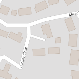
| Cooper Close, Langstone, Newport, NP18 | £ 625,000 | BUY | 8 / 10 | 0.10 KM |
| Chepstow Road, Langstone. Newport | £ 700,000 | BUY | 8 / 10 | 0.22 KM |
| Tregarn Road, Langstone | £ 425,000 | BUY | Unknown | 0.31 KM |
| Chepstow Road, Langstone, Newport | £ 800,000 | BUY | Unknown | 0.31 KM |
Nearby Properties
| Address | Price | Distance |
|---|---|---|
| Claybrook | £ 440,000 | 0.00 KM |
| Corbally | £ 508,000 | 0.00 KM |
| Silverdale | £ 313,000 | 0.06 KM |
| Whipstaff | £ 800,000 | 0.06 KM |
| Glan-y-dwr | £ 445,000 | 0.06 KM |